Geography Context
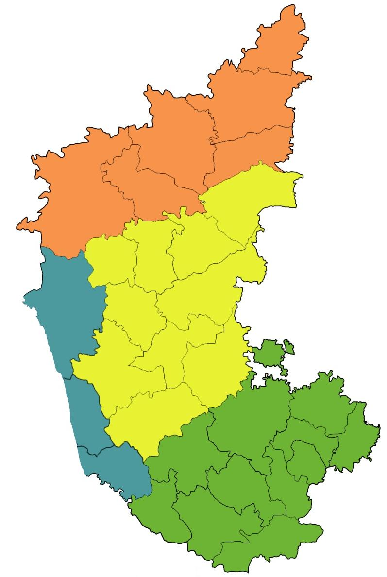
Karnataka is divided into four natural geographic divisions:
1.NORTHERN KARNATAKA PLATEAU : Largely composed of Deccan Trap. Represents a monotonous treeless extensive plateau landscape.General elevation : 300 to 600 m. River plains of the Krishna, the Bhima, the Ghataprabha and the Malaprabha with the intervening watersheds, the step like landscapes, lateritic escarpments, residual hills and ridges break the monotony of this extensive plateau Largely covered with rich black cotton soils.
2.CENTRAL KARNATAKA PLATEAU : The region represents the transitional surface between the Northern Karnataka Plateau of Deccan Trap and Southern Karnataka Plateau with relatively higher surface.Mostly represents the area of Tungabhadra basin. General elevation : 450 to 700 m. Transitional ground is broken by several sets of parallel ridges mainly made up of Dharwar system of rocks. The height of such residual hills is about 900 metres.
3.SOUTHERN KARNATAKA PLATEAU : Largely covers the area of the Cauvery river basin. Gen Elev : 600 to 900 m and is characterised by a higher degree of slope. In the west and south it is enclosed by Western Ghats and the northern part is an interrupted but identifiable high plateau. In the east the valleys of the Cauvery and its tributaries open out to form undulating plains. Residual heights of 1,500 to 1,750 m are found in Mysore district and Kodagu district.
4.COASTAL KARNATAKA : This region is traversed by several ridges and spurs of Western Ghats. General Elevation : 75 m. It has difficult terrain full of rivers, creeks, water falls, peaks and ranges of hills. The coastal region consists of two broad physical units, the plains and the Western Ghats. The Coastal plains, represent a narrow stretch of estuarine and marine plains. The abrupt rise at the eastern flanks forms the Western Ghats. The northern parts of the Ghats are of lower elevation [450-600 metres) as compared to Southern parts (900 to 1,500 metres).
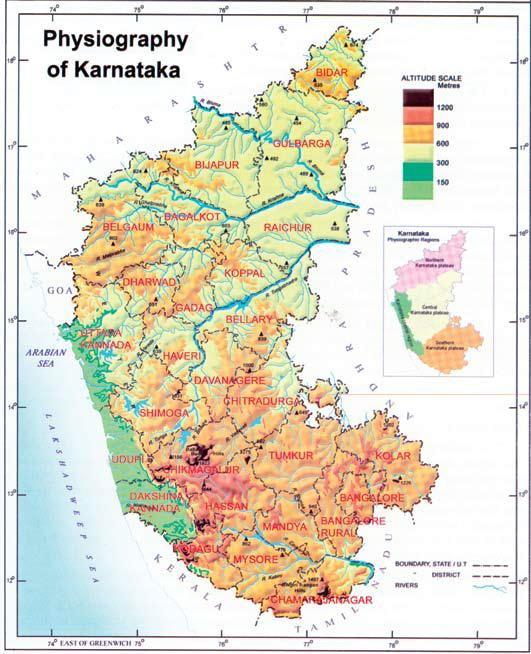